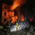
Satellite images obtained by Al Jazeera from the American company “Vantor”, taken on June 29, 2026, showed the continuation of recovery and relief operations in coastal areas in northern Venezuela, after the earthquakes that struck the country last week.
The pictures reveal widespread activity in the vicinity of La Guaira and Macuto, which included removing rubble from collapsed buildings, and attempts to open roads blocked by the rubble, in addition to setting up shelters and relief tents on baseball and football fields and open spaces.
Read also
list of 2 itemsend of list
The pictures also show the presence of American military aircraft at Simón Bolívar International Airport, and the docking of the American amphibious transport ship USS Fort Lauderdale in the port of La Guaira, as part of support and relief efforts to bring aid and supplies into Venezuela.
Relief port
In the port of La Guaira, photos show the American amphibious transport ship USS Fort Lauderdale anchored at the port, in a scene that reflects the entry of naval support into the ongoing relief operations after the earthquakes.
La Guaira is of particular importance because it represents a major sea gateway near the capital, Caracas, and is located close to Simón Bolívar International Airport, making it a focal point for receiving aid and distributing it to the affected areas.
Reading the pictures indicates that the port was no longer just a trading point at this stage, but rather turned into part of a logistical line for bringing supplies across the sea.

Air support
Another photo shows US military aircraft at Simón Bolívar International Airport, located near La Guaira, as part of support and relief efforts.
The airport is one of the most important air traffic ports in the country, which makes the presence of relief aircraft there an indication of the reliance of response operations on two parallel paths: the sea via the port of La Guaira, and the air via the nearby international airport.
This distribution gives relief operations a greater ability to transport supplies, personnel and equipment to the affected areas, especially in light of damaged roads or disruption of the movement of some land routes.

Temporary shelters
The pictures reveal the erection of tents and temporary shelters in several open sites in and around La Guaira, including a baseball field, a football field, and open spaces likely to be used to host those affected or relief and first response teams.
These clusters appear in the form of rows of tents or temporary structures, distributed within sports spaces and open areas, which are sites usually used in disasters to facilitate the organization of shelter, the arrival of ambulance teams, and the distribution of aid.
The density and distribution of these tents indicate that the response phase is no longer limited to urgent rescue, but has moved to organizing temporary shelter and managing the needs of the affected population.


Rubble and roads
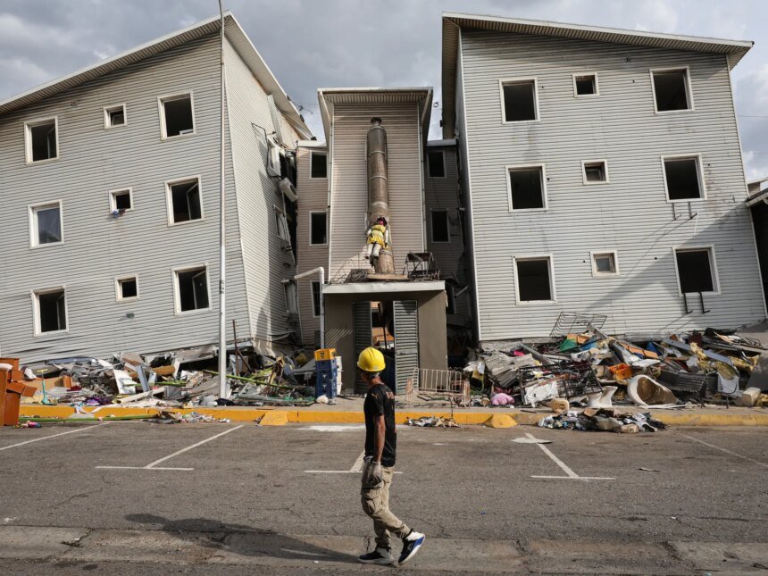
In the town of Macuto, near La Guaira, satellite images show field recovery operations near collapsed buildings, where traces of rubble, equipment or human activity appear in damaged areas.
Another photo also shows work to remove rubble from a road in Makoto, an indication of continued attempts to reopen roads and facilitate the movement of rescue teams and aid.
This point is particularly important because opening roads after disasters is not only related to daily movement, but rather represents a basic condition for the arrival of ambulances, heavy equipment, and supplies to the affected neighborhoods.

Response map
Vantur’s images reveal that the post-earthquake phase in northern Venezuela is still open to extensive rescue and recovery operations, from clearing rubble and opening roads, to setting up temporary shelters in stadiums and public spaces, all the way to using ports and airports to bring in external support.
Between the port of La Guaira, Simón Bolívar International Airport, stadium shelters, and sites of devastation in Macoto, the images draw a preliminary map of relief efforts in a region still trying to regain movement after the disaster.
Satellite images alone do not provide a toll of losses, but they clearly document that the effects of the earthquakes moved from the moment of collapse to the stage of disaster management: temporary shelter, opening roads, removing rubble, and international logistical support arriving by sea and air.