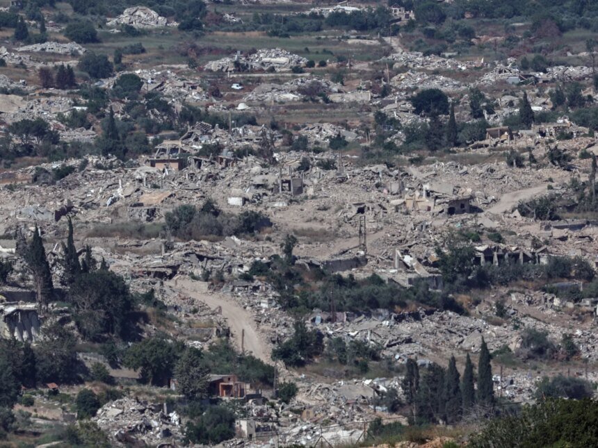
Satellite images analyzed by the Al Jazeera Network’s open source unit showed widespread changes in the town of Markaba in southern Lebanon, in a new visual indication of the extent of the destruction that affected one of the border villages in the Marjayoun district.
A comparison between the images from February 28 and the most recent images available until June 28 reveals a clear change in the town’s urban mass, in a visual pattern consistent with widespread destruction and bulldozing within the residential area and its surroundings.
Read also
list of 3 itemsend of list
The images also show the emergence of new field paths or roads in the vicinity of the town, in addition to changes near an Israeli concentration point located between Markaba and Hula, according to a map prepared by Al Jazeera based on satellite images and spatial data.
The pictures also show traces of bulldozing in areas near that point, reflecting a shift in the landscape around the town, not just its residential buildings.
Compounds change
Visual comparison shows that the broad features of Markaba have changed over the course of 4 months. In the February images, the urban mass appears more regular, with clear streets, buildings, and boundaries within the town.
As for the June photos, large areas appear to have lost their urban regularity, with patches of rubble, new voids, and overlap between the boundaries of roads and damaged buildings.
Circle of incursion
In southern Lebanon, the town of Markaba is no longer just a border village in the Marjayoun district. Rather, during the year 2026, it turned into one of the points that summarize the nature of the new confrontation near the Blue Line. It included an incursion, repeated bombing, bombing of homes, and an Israeli return to the “security zone” area under the title of removing the danger from the settlements in the north.
Markaba is located in Nabatieh Governorate, near the towns of Houla, Taibe, Al-Adisa and Rab Thilaine, and in sensitive geographical contact with the eastern front of the Lebanese-Israeli border.
This location placed it within the scope of military monitoring and ground operations, not only as a residential community, but as part of the border belt that Israel seeks to reshape on the ground.
The importance of Markaba increases due to its proximity to an Israeli concentration point in the area between it and Houla, in addition to its location within the vicinity of villages and hills overlooking internal movement axes in southern Lebanon.

Crossing near a boat
On March 3, 2026, the United Nations Interim Force in Lebanon (UNIFIL) said that Israeli army soldiers crossed into Lebanese areas near Markaba, Al-Adisa, Kafr Kila, and Ramiya, before returning south of the Blue Line.
UNIFIL considered these incidents a serious violation of Resolution 1701, noting that it also recorded air strikes, shooting incidents and air violations during that period.
Thus, the name “Makaba” entered early in the timeline of the new ground escalation, as one of the points of direct contact.
House bombing
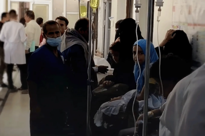
On March 20, the Lebanese National News Agency reported that the town of Markaba was subjected to raids and artillery shelling. On the same day, field coverage reported continued fighting in the vicinity of Markaba, with exchanged targets near the town.
This stage indicates the movement of a vehicle from a site of observation and limited incursion to an arena of clashes and fire pressure, as the town and its entrances and surroundings became part of the theater of operations south of Marjayoun.
In April, the Israeli army published a video clip showing the bombing of a number of homes in the town of Markaba, a practice that also appeared in other southern towns during the same period. These accounts intersect with what later appears in satellite images of widespread changes in the urban fabric of the town.
Constant destruction
In addition to urban destruction, satellite images show changes in the vicinity of the Israeli concentration point located between Markaba and Hula, in addition to bulldozing in areas close to it and the emergence of field paths or new roads in the vicinity of the town.
Satellite images also showed that the destruction operations are still continuing, and the images recorded a change in the urban structure in May and June.
Why compound?
Markaba derives its importance from several overlapping factors, such as its border location in the Marjayoun district, near Houla, Al-Adisa, and Al-Taybeh, which are towns located on one of the most sensitive axes of the south.
It also gains importance because of its proximity to observation points, hills, and corridors linking the border villages to the southern depths, which makes it valuable in any attempt to establish a separation belt or buffer zone.
Israel says that its operations in southern Lebanon target Hezbollah infrastructure, and that it seeks to protect the residents of northern Israel from missiles, drones, and infiltration.
In March, Israeli Defense Minister Yisrael Katz said that the goal of the move in southern Lebanon was to create a “defensive space” and remove the threat. Later, Israeli statements confirmed that the army would maintain a security zone in southern Lebanon, while continuing work to dismantle what Tel Aviv describes as Hezbollah’s military structures.
On June 24, Israeli media quoted Katz as saying that the Israeli army would not withdraw from the security zone in southern Lebanon, “even if there was an American request,” adding that hundreds of thousands of Lebanese residents would not return to their homes in the areas they had evacuated, according to published statements.
Legal reading
House bombings and prevention of returns raise broad legal and humanitarian questions. Human rights organizations have warned that the widespread destruction of homes and civilian structures, and preventing residents from returning to their towns, may amount to serious violations of international humanitarian law.
Amnesty International said that mass evacuation and non-return orders in southern Lebanon were used as a tool to displace residents from large areas, while Human Rights Watch warned that the deliberate destruction of homes and forced displacement could constitute war crimes.
Markaba, like other border villages in southern Lebanon, reveals a scene that goes beyond the impact of direct bombing. The issue is no longer just the destruction of buildings, but rather the reshaping of the geography of return in the south with destroyed villages, roads cut off or under monitoring, and residents who do not know when they can return safely.