Published on 6/14/2026
In the central sector of southern Lebanon, the destruction in the towns of Beit Yahoun and Hadatha does not appear to be just a side effect of the war. Satellite images reveal a profound change in the features of two towns located on a vital axis between Tibnin and Bint Jbeil, and within a military zone drawn by Israel within Lebanese territory, known as the “yellow line.”
Satellite images obtained by the Al Jazeera Network’s Open Source Unit, and taken by Airbus and Planet Labs between March 13, 2025 and June 11, 2026, show widespread destruction in residential areas and main and internal roads in the two towns, with urban blocks turning into rubble and open voids.
Read also
list of 2 itemsend of list
These photos place Beit Yahoun and Hadatha at the heart of a broader question about the future of the villages located within the areas isolated by Israel in southern Lebanon, where the impact of the war is not limited to direct destruction, but extends to the conditions of return, movement, and daily life.
The two towns are located between 6.6 and 7.6 kilometers from the highest border point along the Blue Line, and they also pass within the area that has become known as the yellow line drawn by Israel within Lebanese territory, at a depth of about 12 kilometers.

What do the pictures show?
Visual comparisons between reference images and more recent footage reveal a major transformation in the urban landscape inside the two towns, as they show residential blocks turned into rubble and open voids, with clear damage to the road network, especially the main road in Hadatha and the roads linking it to neighboring towns such as Haris and Aita al-Jabal, in addition to internal roads.
This type of damage reflects destruction that extends to basic infrastructure and movement and access paths, which exacerbates the difficulty of the population’s return and indicates a direct impact on agricultural activity and daily life in the region.
In Beit Yahoun, the photos show a similar pattern of destruction, with clear damage to buildings on both sides of the main road, especially in the area associated with what is historically known as the Beit Yahoun crossing on the Tibnin/Bint Jbeil road.
Why Beit Yahon and Hadada?
The two towns are of particular importance due to their geographical location. They are located on the Tibnin/Bint Jbeil axis, which is one of the most important movement axes in the central sector of southern Lebanon. Controlling the vicinity of the Beit Yahoun Junction practically means affecting the connection between Bint Jbeil and its northern surroundings, which explains the sensitivity of this region in any ground military operation or in attempts to impose buffer zones.
The fact that the two towns are located within the area isolated by the Israeli Yellow Line gives them additional importance, as the line isolates dozens of Lebanese towns and a large area of the south of the country from its internal surroundings.
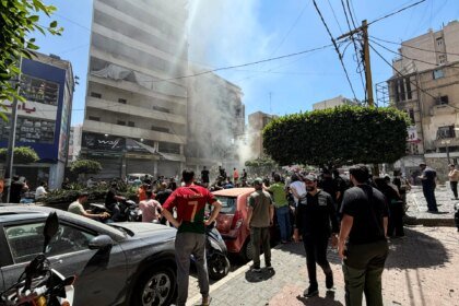
This destruction comes in an extremely cruel humanitarian context. According to the Lebanese Ministry of Health, the cumulative toll of the aggression as of June 11 reached 3,711 dead and 11,483 wounded. Official Lebanese data also indicate that the number of displaced people exceeded one million people, meaning more than 20% of the Lebanese population.
The Israeli army says it is targeting Hezbollah’s infrastructure in southern Lebanon, in response to rocket fire and marches, and claims that the party is using civilian areas to store weapons and manage its operations.
Defense Minister Yisrael Katz also stated that “all homes in the Lebanese villages near the border will be destroyed according to the Rafah and Beit Hanoun model,” while Prime Minister Benjamin Netanyahu instructed his army to continue expanding the security belt and establish a presence within the buffer zone.
Yesterday, Saturday, the army published a statement in which it said that during the past 24 hours, it had bombed more than 70 sites belonging to Hezbollah’s infrastructure in southern Lebanon.