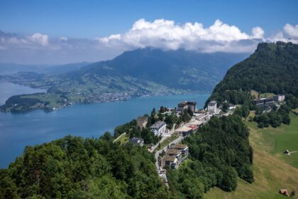
The B1 Bridge in western Tehran has not only become the most famous bridge targeted in the war because it is the largest architecturally, but also because US President Donald Trump personally announced its bombing on April 2, and then linked this to a broader threat to target more bridges and power stations in Iran.
But the importance of “B1” alone does not explain this file. The most important question is not: Why did this bridge emerge in the media? Rather: Why were these bridges specifically targeted?
It is understood from Iranian sources that the targeting was not focused on ordinary bridges or isolated facilities, but rather on road and railway nodes whose attack could disrupt transport movement, impose alternative routes, disrupt the movement of passengers and goods, or at least test the state’s ability to keep these networks operating under pressure.
Iran officially announced that 24 bridges and intersections were targeted during the 40-day war, without publishing – yet – a complete official list of these facilities. What has appeared in Iranian sources – so far – is only a partial list of the names of some of the targeted sites, and not a complete inventory of them.

Among the facilities whose names were mentioned in the Iranian coverage are bridges on road axes such as Hashtroud on the Tabriz-Zanjan road, Turkmenchay, and “B1” in Karaj, Alborz Province.
Facilities also appeared on railway lines, such as the bridges: Haft Cheshmeh in Mayana, Aminabad in Zanjan, Yahya Abad in Kashan in the center of the country, Bagh Yaik in Qom, south of Tehran, Chahar Bagh in Alborz Governorate, and Qalaat Noh on the railway track near Tehran. In addition to these bridges, the Pune Tunnel also appeared on the Khorramabad-Borujerd-Arak axis.
According to what has been published so far, the names in circulation are almost limited to bridges, railway facilities and tunnels, while the named intersection does not appear clearly despite its presence in the official number.
What unites these sites – as their locations and functions suggest – is that they are not equal in form, but they are close in operational value. Some of them are located on major road axes between governorates, some are on sensitive national or regional railway lines, and some represent crossing points that are difficult to replace quickly without diverting or slowing down movement.
From this perspective, targeting it seems closer to targeting the network’s ability to operate smoothly, and not merely targeting engineering facilities as separate targets.

The basic issue emerges here, which is that all of these bridges are not equal in importance, but what they have in common is that they are influential within the transportation network.
Symbolism and axes of disruption
The B1 Bridge is the most prominent politically and medially, because Trump has turned it into a direct threat, and because it is linked to the Northern Road Project in Karaj, which Iranian reports say is intended to relieve pressure on the Tehran-Karaj-Qazvin axis, which is one of the busiest and most vital axes in Iran, and is linked to transit traffic between several provinces.
Hence, “P1” acquired a symbolic value that goes beyond its geometric size itself.
But if we move from political symbolism to the impact on the transportation network, some iron bridges appear more sensitive.
Describe Iranian sources say that the Qom railway track is located at the intersection of two main axes linking western Iran to its east and north to its south. They indicate that 61 passenger trains pass daily through this route, and that Qom – via the Qom and Muhammadiyah stations – is the third largest passenger station in the country by receiving about 8,000 passengers daily.
The Qalaat Noh Bridge is also located on the Tehran-Mashhad line, which is one of the most important railway lines in Iran, while Aminabad and Haft Cheshmeh are connected to the northwest lines that serve the movement of goods and passengers together.

Therefore, the reason for targeting becomes clearer, as these bridges are not just local crossing points, but rather sites where hitting them could lead to a partial disruption of the network, slow down movement, or force the authorities to open quick alternatives, creating logistical and psychological pressure at the same time.
Therefore, these bridges are less present in the political debate than B1, but they may have a more severe impact when measured by their ability to disrupt transportation throughout the country.
As for the rest of the facilities – such as Hastrud, Turkmenchay, Yahyaabad, Chahar Bagh, and the Pune Tunnel – they are also important, but to varying degrees. Some of them are located on express or regional axes, the targeting of which requires opening alternative paths and diverting traffic, while others are linked to local or regional railway lines that require rapid restart so that the effects of disruption do not expand.
Thus, the difference between these facilities is not between what is important and what is not important, but rather between major national transport nodes and supporting operational or regional nodes.
Restoration file
In the restoration file, Tehran tried to show its ability to restore movement quickly, as Iranian official reports spoke of reopening some of the targeted bridges and tunnels within 48 hours, and mentioned examples of the Chahar Bagh railway track, the Rawansar Bridge, and the rapid opening of the Khorramabad-Balzal axis.
On the other hand, Heshtrud needed to open a safe alternative route within about a week before movement was restored. As for “B1”, it is still a different case, as the latest Iranian reports say that technical studies and estimating the cost of rebuilding it are still ongoing, which means that the most famous targeted bridges have not yet entered the category of “quick repair” that applies to other facilities.
The bottom line is that targeting these bridges in particular was not – as it appears from their locations and functions – targeting only concrete structures, but rather targeting the movement nodes themselves.
Some of them carry political and engineering symbolism, such as “B1,” and others carry a greater network weight because they are located on road or railway routes that influence the transport of passengers and goods.
Therefore, what explains its targeting is not only its shape or size, but rather its ability to affect the transportation network if it is disrupted or the state is forced to circumvent it.